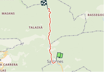
![](/images/other/stat-length.png)
![Randonnée A pied Sales de Llierca - L'Alta Garrotxa de Vayreda - Photo](https://media.geolcdn.com/t/1900/400/f52cff0d-f5c0-40bd-a266-b7fc01d75938.jpeg&format=pjpeg&maxdim=2)
L'Alta Garrotxa de Vayreda
SityTrail - itinéraires balisés pédestres
Tous les sentiers balisés d’Europe GUIDE+
![Longueur](/images/other/stat-length.png)
![Altitude max](https://static1.geolcdn.com/siteimages/upload/files/1508320355ic_sort_altitude_max_24dp.png)
![Dénivelé positif](https://static1.geolcdn.com/siteimages/upload/files/1508320355ic_sort_den_pos_24dp.png)
![Km-Effort](/images/other/stat-length.png)
![Altitude min](https://static1.geolcdn.com/siteimages/upload/files/1508320355ic_sort_altitude_min_24dp.png)
![Dénivelé négatif](https://static1.geolcdn.com/siteimages/upload/files/1508320355ic_sort_den_neg_24dp.png)
![Boucle](https://static1.geolcdn.com/siteimages/upload/files/16400158638029165_repeat_loop_refresh_sync_direction_icon.png)
![A pied](https://static1.geolcdn.com/sitytour/trail-icons/100.png)
2h10
Difficulté : Facile
![Scannez ce code QR pour ouvrir la randonnée dans l'application SityTrail](https://capi.geolives.com/qq0zvz2zws4bq2lad0pu/sitytour/trails/3110412/qr.png?size=200)
Application GPS de randonnée GRATUITE
À propos
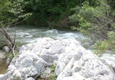
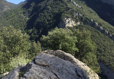
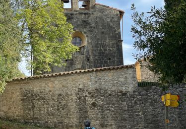
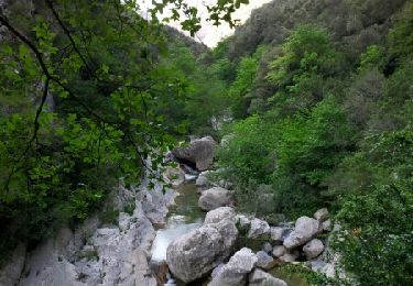
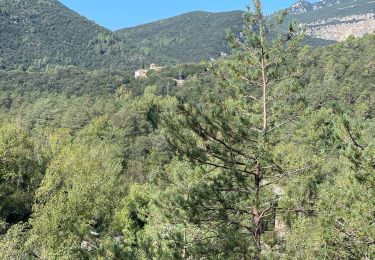
Randonnée A pied de 6,7 km à découvrir à Catalogne, Gérone, Sales de Llierca. Cette randonnée est proposée par SityTrail - itinéraires balisés pédestres.
Description
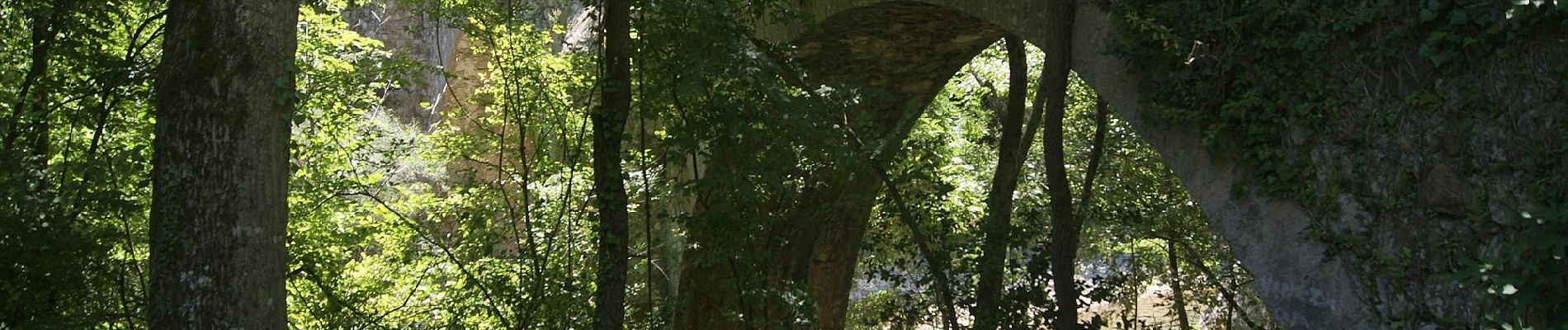
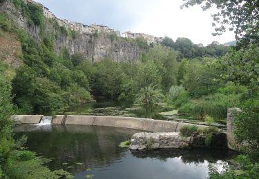
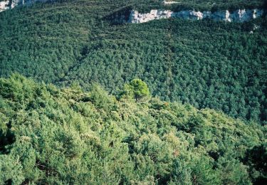
La Punyalada ens ofereix una oportunitat única per descobrir l’Alta Garrotxa. Els racons on Marian Vayreda va situar els protagonistes de la seva cèlebre novel·la són escenari d’aquesta ruta.
Site web: https://www.itinerannia.net/ca/itineraris/l-alta-garrotxa-de-vayreda/
Localisation
Commentaires
Randonnées à proximité
![Randonnée A pied Montagut i Oix - Montagut-Ermita de la Devesa-Baumes de la Caxurma - Photo](https://media.geolcdn.com/t/375/260/1fea31c6-a1f7-4cd5-9fb2-91cc07d26e9e.jpeg&format=jpg&maxdim=2)
![A pied A pied](https://static1.geolcdn.com/sitytour/trail-icons/100.png)
A pied
![](/images/other/stat-length.png)
![](https://static1.geolcdn.com/siteimages/upload/files/16400158638029165_repeat_loop_refresh_sync_direction_icon.png)
![Randonnée A pied Tortellà - Els Comuns. Tortellà - Photo](https://media.geolcdn.com/t/375/260/77e3f571-f015-4fa3-9216-7388ce4a3e2a.jpeg&format=jpg&maxdim=2)
![A pied A pied](https://static1.geolcdn.com/sitytour/trail-icons/100.png)
A pied
![](/images/other/stat-length.png)
![](https://static1.geolcdn.com/siteimages/upload/files/16400158638029165_repeat_loop_refresh_sync_direction_icon.png)
![Randonnée A pied Montagut i Oix - 186 - Photo](https://media.geolcdn.com/t/375/260/2fb22bb4-f048-4ae0-954f-9845c4c16433.jpeg&format=jpg&maxdim=2)
![A pied A pied](https://static1.geolcdn.com/sitytour/trail-icons/100.png)
![Randonnée Marche Sales de Llierca - Sadernes Sant Aniol - Photo](https://media.geolcdn.com/t/375/260/db335b61-6ee0-4b21-a956-4377b2f8d2ee.jpg&format=jpg&maxdim=2)
![Marche Marche](https://static1.geolcdn.com/sitytour/trail-icons/101.png)
Marche
![](/images/other/stat-length.png)
![](https://static1.geolcdn.com/siteimages/upload/files/16400158638029165_repeat_loop_refresh_sync_direction_icon.png)
![Randonnée Marche Tortellà - Llercat Saderne - Photo](https://media.geolcdn.com/t/375/260/6cdc333b-3a4b-4d4a-a55a-45043c793942.jpg&format=jpg&maxdim=2)
![Marche Marche](https://static1.geolcdn.com/sitytour/trail-icons/101.png)
Marche
![](/images/other/stat-length.png)
![](https://static1.geolcdn.com/siteimages/upload/files/16400158638029165_repeat_loop_refresh_sync_direction_icon.png)
![Randonnée Marche Sales de Llierca - Gorges de St Aniol Sadernes - Photo](https://media.geolcdn.com/t/375/260/ext.jpg?maxdim=2&url=https%3A%2F%2Fservices.sitytrail.com%2FGeolivesWS%2FDownloadMedia.ashx%3FTrailID%3D419570%26Media%3Dfix__20150510175851.jpg)
![Marche Marche](https://static1.geolcdn.com/sitytour/trail-icons/101.png)
Marche
![](/images/other/stat-length.png)
![](https://static1.geolcdn.com/siteimages/upload/files/16400158638029165_repeat_loop_refresh_sync_direction_icon.png)
![Randonnée Marche Sales de Llierca - Pont de Llerca Saderne variante à compléter - Photo](https://media.geolcdn.com/t/375/260/fb165c9a-bd67-49ad-93ac-789b57a6b3b3.jpg&format=jpg&maxdim=2)
![Marche Marche](https://static1.geolcdn.com/sitytour/trail-icons/101.png)
Marche
![](/images/other/stat-length.png)
![](https://static1.geolcdn.com/siteimages/upload/files/16400158638029165_repeat_loop_refresh_sync_direction_icon.png)
![Randonnée Marche Montagut i Oix - talaixa - Photo](https://media.geolcdn.com/t/375/260/ext.jpg?maxdim=2&url=https%3A%2F%2Fstatic1.geolcdn.com%2Fsiteimages%2Fupload%2Ffiles%2F1553511878bg_sport_marche.png)
![Marche Marche](https://static1.geolcdn.com/sitytour/trail-icons/101.png)
Marche
![](/images/other/stat-length.png)
![](https://static1.geolcdn.com/siteimages/upload/files/16400158638029165_repeat_loop_refresh_sync_direction_icon.png)
![Randonnée Marche Sales de Llierca - Monastere St Aniol d'Aguja - Photo](https://media.geolcdn.com/t/375/260/ext.jpg?maxdim=2&url=https%3A%2F%2Fstatic1.geolcdn.com%2Fsiteimages%2Fupload%2Ffiles%2F1553511878bg_sport_marche.png)
![Marche Marche](https://static1.geolcdn.com/sitytour/trail-icons/101.png)
Marche
![](/images/other/stat-length.png)
![](https://static1.geolcdn.com/siteimages/upload/files/16400158638029165_repeat_loop_refresh_sync_direction_icon.png)